
Designbibliotek
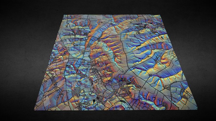
TF28 (Lincolnshire Wolds) - 3D lidar landscape
av NOWTAG
GratisCC BYSketchfab
100 sqkm enhanced lidar centred on TF250850 showing part of the Lincolnshire Wolds. 3D model from enhanced LIDAR (DSM, 1m) © Environment Agency copyright and/or database right 2022. All rights reserved. Vertical exaggeration x1.5 Enhancement of the LIDAR was carried out using tools made available
Den här designen finns på Sketchfab. Filerna laddas ner därifrån under den angivna licensen.
| Licens | CC BY |
|---|---|
| Källa | Sketchfab |
| Designer | NOWTAG |
| Erkännande | NOWTAG on Sketchfab · CC-BY 4.0 (attribution required) · Attribution required |
| Taggar | landscape, lidar, dsm, lincolnshire, archaeology |
100 sqkm enhanced lidar centred on TF250850 showing part of the Lincolnshire Wolds.
3D model from enhanced LIDAR (DSM, 1m) © Environment Agency copyright and/or database right 2022. All rights reserved. Vertical exaggeration x1.5
Enhancement of the LIDAR was carried out using tools made available in the QGIS plugin, Relief Visualization Toolbox. Kokalj, Žiga & Hesse, Ralf. (2017). Airborne laser scanning raster data visualization: A Guide to Good Practice.
3D landscape model made using the QGIS2threejs plugin for QGIS.
Publicera din design
Ladda upp STL-, 3MF- eller OBJ-filer i appen. Varje uppladdning granskas innan den visas här, och designers behåller 80 % av varje betald försäljning.