
Ontwerpbibliotheek
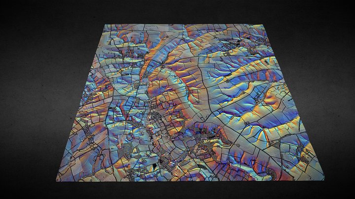
TF28 (Lincolnshire Wolds) - 3D lidar landscape
door NOWTAG
GratisCC BYSketchfab
100 sqkm enhanced lidar centred on TF250850 showing part of the Lincolnshire Wolds. 3D model from enhanced LIDAR (DSM, 1m) © Environment Agency copyright and/or database right 2022. All rights reserved. Vertical exaggeration x1.5 Enhancement of the LIDAR was carried out using tools made available
Dit ontwerp wordt gehost op Sketchfab. De bestanden download je daar, onder de vermelde licentie.
| Licentie | CC BY |
|---|---|
| Bron | Sketchfab |
| Ontwerper | NOWTAG |
| Naamsvermelding | NOWTAG on Sketchfab · CC-BY 4.0 (attribution required) · Attribution required |
| Tags | landscape, lidar, dsm, lincolnshire, archaeology |
100 sqkm enhanced lidar centred on TF250850 showing part of the Lincolnshire Wolds.
3D model from enhanced LIDAR (DSM, 1m) © Environment Agency copyright and/or database right 2022. All rights reserved. Vertical exaggeration x1.5
Enhancement of the LIDAR was carried out using tools made available in the QGIS plugin, Relief Visualization Toolbox. Kokalj, Žiga & Hesse, Ralf. (2017). Airborne laser scanning raster data visualization: A Guide to Good Practice.
3D landscape model made using the QGIS2threejs plugin for QGIS.
Publiceer je ontwerpen
Upload STL-, 3MF- of OBJ-bestanden in de app. Elke upload wordt gecontroleerd voordat hij hier verschijnt, en ontwerpers houden 80% van elke betaalde verkoop.