
Libreria di design
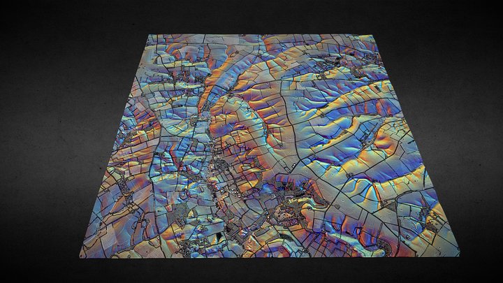
TF28 (Lincolnshire Wolds) - 3D lidar landscape
di NOWTAG
GratisCC BYSketchfab
100 sqkm enhanced lidar centred on TF250850 showing part of the Lincolnshire Wolds. 3D model from enhanced LIDAR (DSM, 1m) © Environment Agency copyright and/or database right 2022. All rights reserved. Vertical exaggeration x1.5 Enhancement of the LIDAR was carried out using tools made available
Questo design è ospitato su Sketchfab. I file si scaricano da lì, con la licenza indicata.
| Licenza | CC BY |
|---|---|
| Fonte | Sketchfab |
| Designer | NOWTAG |
| Attribuzione | NOWTAG on Sketchfab · CC-BY 4.0 (attribution required) · Attribution required |
| Tag | landscape, lidar, dsm, lincolnshire, archaeology |
100 sqkm enhanced lidar centred on TF250850 showing part of the Lincolnshire Wolds.
3D model from enhanced LIDAR (DSM, 1m) © Environment Agency copyright and/or database right 2022. All rights reserved. Vertical exaggeration x1.5
Enhancement of the LIDAR was carried out using tools made available in the QGIS plugin, Relief Visualization Toolbox. Kokalj, Žiga & Hesse, Ralf. (2017). Airborne laser scanning raster data visualization: A Guide to Good Practice.
3D landscape model made using the QGIS2threejs plugin for QGIS.
Pubblica i tuoi design
Carica file STL, 3MF o OBJ dall'app. Ogni caricamento viene verificato prima di comparire qui, e i designer trattengono l'80% di ogni vendita a pagamento.