
Biblioteca de designs
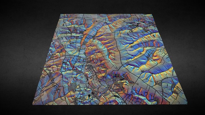
TF28 (Lincolnshire Wolds) - 3D lidar landscape
por NOWTAG
GrátisCC BYSketchfab
100 sqkm enhanced lidar centred on TF250850 showing part of the Lincolnshire Wolds. 3D model from enhanced LIDAR (DSM, 1m) © Environment Agency copyright and/or database right 2022. All rights reserved. Vertical exaggeration x1.5 Enhancement of the LIDAR was carried out using tools made available
Este design está hospedado no Sketchfab. Os arquivos são baixados de lá, sob a licença indicada.
| Licença | CC BY |
|---|---|
| Fonte | Sketchfab |
| Designer | NOWTAG |
| Atribuição | NOWTAG on Sketchfab · CC-BY 4.0 (attribution required) · Attribution required |
| Tags | landscape, lidar, dsm, lincolnshire, archaeology |
100 sqkm enhanced lidar centred on TF250850 showing part of the Lincolnshire Wolds.
3D model from enhanced LIDAR (DSM, 1m) © Environment Agency copyright and/or database right 2022. All rights reserved. Vertical exaggeration x1.5
Enhancement of the LIDAR was carried out using tools made available in the QGIS plugin, Relief Visualization Toolbox. Kokalj, Žiga & Hesse, Ralf. (2017). Airborne laser scanning raster data visualization: A Guide to Good Practice.
3D landscape model made using the QGIS2threejs plugin for QGIS.
Publique seus designs
Envie arquivos STL, 3MF ou OBJ pelo app. Cada envio é revisado antes de aparecer aqui, e os designers ficam com 80% de cada venda paga.