
Designbibliothek
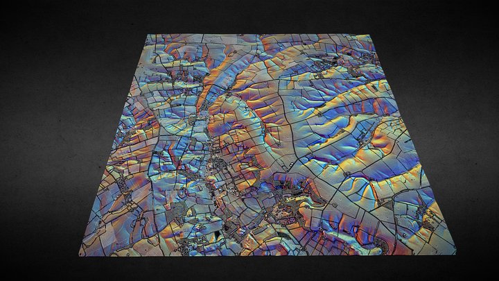
TF28 (Lincolnshire Wolds) - 3D lidar landscape
von NOWTAG
KostenlosCC BYSketchfab
100 sqkm enhanced lidar centred on TF250850 showing part of the Lincolnshire Wolds. 3D model from enhanced LIDAR (DSM, 1m) © Environment Agency copyright and/or database right 2022. All rights reserved. Vertical exaggeration x1.5 Enhancement of the LIDAR was carried out using tools made available
Dieses Design wird auf Sketchfab gehostet. Die Dateien werden dort unter der angegebenen Lizenz heruntergeladen.
| Lizenz | CC BY |
|---|---|
| Quelle | Sketchfab |
| Designer | NOWTAG |
| Namensnennung | NOWTAG on Sketchfab · CC-BY 4.0 (attribution required) · Attribution required |
| Tags | landscape, lidar, dsm, lincolnshire, archaeology |
100 sqkm enhanced lidar centred on TF250850 showing part of the Lincolnshire Wolds.
3D model from enhanced LIDAR (DSM, 1m) © Environment Agency copyright and/or database right 2022. All rights reserved. Vertical exaggeration x1.5
Enhancement of the LIDAR was carried out using tools made available in the QGIS plugin, Relief Visualization Toolbox. Kokalj, Žiga & Hesse, Ralf. (2017). Airborne laser scanning raster data visualization: A Guide to Good Practice.
3D landscape model made using the QGIS2threejs plugin for QGIS.
Veröffentliche deine Designs
Lade STL-, 3MF- oder OBJ-Dateien in der App hoch. Jeder Upload wird geprüft, bevor er hier erscheint, und Designer behalten 80 % jedes bezahlten Verkaufs.