
Библиотека моделей
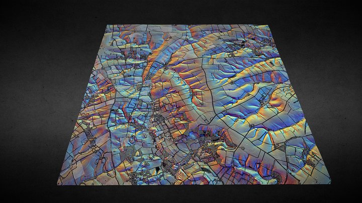
TF28 (Lincolnshire Wolds) - 3D lidar landscape
автор: NOWTAG
БесплатноCC BYSketchfab
100 sqkm enhanced lidar centred on TF250850 showing part of the Lincolnshire Wolds. 3D model from enhanced LIDAR (DSM, 1m) © Environment Agency copyright and/or database right 2022. All rights reserved. Vertical exaggeration x1.5 Enhancement of the LIDAR was carried out using tools made available
Эта модель размещена на Sketchfab. Файлы скачиваются оттуда на условиях указанной лицензии.
| Лицензия | CC BY |
|---|---|
| Источник | Sketchfab |
| Автор | NOWTAG |
| Указание авторства | NOWTAG on Sketchfab · CC-BY 4.0 (attribution required) · Attribution required |
| Теги | landscape, lidar, dsm, lincolnshire, archaeology |
100 sqkm enhanced lidar centred on TF250850 showing part of the Lincolnshire Wolds.
3D model from enhanced LIDAR (DSM, 1m) © Environment Agency copyright and/or database right 2022. All rights reserved. Vertical exaggeration x1.5
Enhancement of the LIDAR was carried out using tools made available in the QGIS plugin, Relief Visualization Toolbox. Kokalj, Žiga & Hesse, Ralf. (2017). Airborne laser scanning raster data visualization: A Guide to Good Practice.
3D landscape model made using the QGIS2threejs plugin for QGIS.
Публикуйте свои модели
Загружайте файлы STL, 3MF или OBJ из приложения. Каждая загрузка проверяется до публикации, а авторы получают 80% от каждой платной продажи.