
設計庫
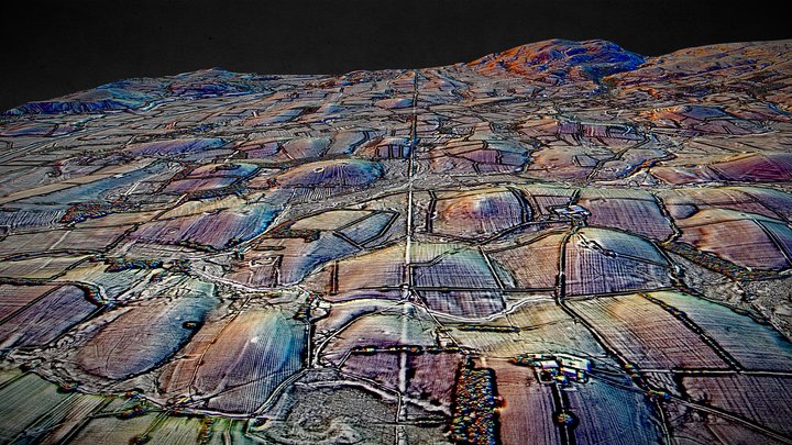
SD67 (dsm) - 3D LiDAR landscape
作者:NOWTAG
免費CC BYSketchfab
100 sqkm enhanced LiDAR centred on SD 6500 7500 between Kirkby Lonsdale & Ingleton in Westmoreland (Cumbria) and North Yorkshire. Includes part of the Yorkshire Dales National Park. 3D model from enhanced LIDAR (DSM, 1m) © Environment Agency copyright and/or database right 2022. All rights reserve
此設計託管於 Sketchfab。檔案需依所示授權從該網站下載。
| 授權 | CC BY |
|---|---|
| 來源 | Sketchfab |
| 設計者 | NOWTAG |
| 姓名標示 | NOWTAG on Sketchfab · CC-BY 4.0 (attribution required) · Attribution required |
| 標籤 | landscape, lidar, dsm, cumbria, archaeology, yorkshire-dales |
100 sqkm enhanced LiDAR centred on SD 6500 7500 between Kirkby Lonsdale & Ingleton in Westmoreland (Cumbria) and North Yorkshire.
Includes part of the Yorkshire Dales National Park.
3D model from enhanced LIDAR (DSM, 1m) © Environment Agency copyright and/or database right 2022. All rights reserved. Vertical exaggeration x1.5
Enhancement of the LIDAR was carried out using tools made available in the QGIS plugin, Relief Visualization Toolbox. Kokalj, Žiga & Hesse, Ralf. (2017). Airborne laser scanning raster data visualization: A Guide to Good Practice.
3D landscape model made using the QGIS2threejs plugin for QGIS.
發布你的設計
在 App 中上傳 STL、3MF 或 OBJ 檔案。每個上傳在出現在這裡之前都會經過審核,設計者可獲得每筆付費銷售的 80%。