
设计库
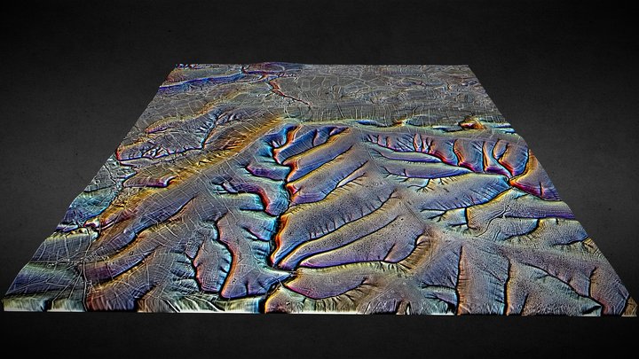
SU05 (dtm) - 3D LiDAR landscape
作者:NOWTAG
免费CC BYSketchfab
100 sqkm enhanced LiDAR centred on SU 0500 5500 Including part of Salisbury Plain SE of Devizes in the county of Wiltshire. 3D model from enhanced LIDAR (DTM, 1m) © Environment Agency copyright and/or database right 2022. All rights reserved. Vertical exaggeration x1.5 Enhancement of the LIDAR was
此设计托管在 Sketchfab。文件需从该网站按所示许可证下载。
| 许可证 | CC BY |
|---|---|
| 来源 | Sketchfab |
| 设计者 | NOWTAG |
| 署名 | NOWTAG on Sketchfab · CC-BY 4.0 (attribution required) · Attribution required |
| 标签 | landscape, lidar, henge, salisbury-plain, archaeology, marden |
100 sqkm enhanced LiDAR centred on SU 0500 5500 Including part of Salisbury Plain SE of Devizes in the county of Wiltshire.
3D model from enhanced LIDAR (DTM, 1m) © Environment Agency copyright and/or database right 2022. All rights reserved. Vertical exaggeration x1.5
Enhancement of the LIDAR was carried out using tools made available in the QGIS plugin, Relief Visualization Toolbox. Kokalj, Žiga & Hesse, Ralf. (2017). Airborne laser scanning raster data visualization: A Guide to Good Practice.
3D landscape model made using the QGIS2threejs plugin for QGIS.
发布你的设计
在应用中上传 STL、3MF 或 OBJ 文件。每个上传在出现在这里之前都会经过审核,设计者可获得每笔付费销售的 80%。