
Biblioteka projektów
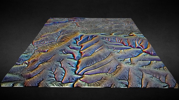
SU05 (dtm) - 3D LiDAR landscape
autor: NOWTAG
Za darmoCC BYSketchfab
100 sqkm enhanced LiDAR centred on SU 0500 5500 Including part of Salisbury Plain SE of Devizes in the county of Wiltshire. 3D model from enhanced LIDAR (DTM, 1m) © Environment Agency copyright and/or database right 2022. All rights reserved. Vertical exaggeration x1.5 Enhancement of the LIDAR was
Ten projekt jest hostowany w Sketchfab. Pliki pobiera się stamtąd, na podanej licencji.
| Licencja | CC BY |
|---|---|
| Źródło | Sketchfab |
| Projektant | NOWTAG |
| Uznanie autorstwa | NOWTAG on Sketchfab · CC-BY 4.0 (attribution required) · Attribution required |
| Tagi | landscape, lidar, henge, salisbury-plain, archaeology, marden |
100 sqkm enhanced LiDAR centred on SU 0500 5500 Including part of Salisbury Plain SE of Devizes in the county of Wiltshire.
3D model from enhanced LIDAR (DTM, 1m) © Environment Agency copyright and/or database right 2022. All rights reserved. Vertical exaggeration x1.5
Enhancement of the LIDAR was carried out using tools made available in the QGIS plugin, Relief Visualization Toolbox. Kokalj, Žiga & Hesse, Ralf. (2017). Airborne laser scanning raster data visualization: A Guide to Good Practice.
3D landscape model made using the QGIS2threejs plugin for QGIS.
Opublikuj swoje projekty
Prześlij pliki STL, 3MF lub OBJ w aplikacji. Każdy plik jest sprawdzany, zanim pojawi się tutaj, a projektanci zachowują 80% z każdej płatnej sprzedaży.