
Libreria di design
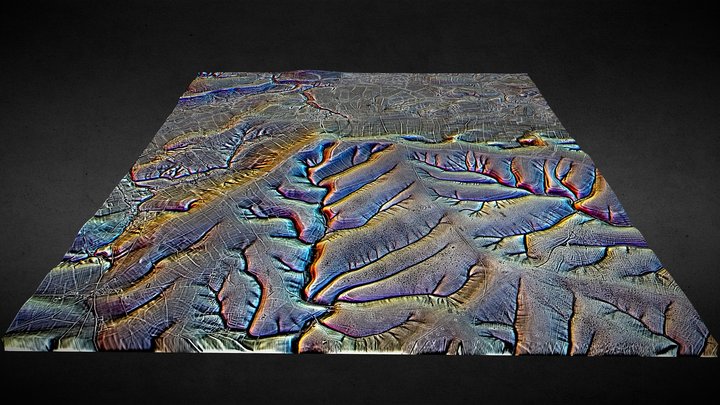
SU05 (dtm) - 3D LiDAR landscape
di NOWTAG
GratisCC BYSketchfab
100 sqkm enhanced LiDAR centred on SU 0500 5500 Including part of Salisbury Plain SE of Devizes in the county of Wiltshire. 3D model from enhanced LIDAR (DTM, 1m) © Environment Agency copyright and/or database right 2022. All rights reserved. Vertical exaggeration x1.5 Enhancement of the LIDAR was
Questo design è ospitato su Sketchfab. I file si scaricano da lì, con la licenza indicata.
| Licenza | CC BY |
|---|---|
| Fonte | Sketchfab |
| Designer | NOWTAG |
| Attribuzione | NOWTAG on Sketchfab · CC-BY 4.0 (attribution required) · Attribution required |
| Tag | landscape, lidar, henge, salisbury-plain, archaeology, marden |
100 sqkm enhanced LiDAR centred on SU 0500 5500 Including part of Salisbury Plain SE of Devizes in the county of Wiltshire.
3D model from enhanced LIDAR (DTM, 1m) © Environment Agency copyright and/or database right 2022. All rights reserved. Vertical exaggeration x1.5
Enhancement of the LIDAR was carried out using tools made available in the QGIS plugin, Relief Visualization Toolbox. Kokalj, Žiga & Hesse, Ralf. (2017). Airborne laser scanning raster data visualization: A Guide to Good Practice.
3D landscape model made using the QGIS2threejs plugin for QGIS.
Pubblica i tuoi design
Carica file STL, 3MF o OBJ dall'app. Ogni caricamento viene verificato prima di comparire qui, e i designer trattengono l'80% di ogni vendita a pagamento.