
डिज़ाइन लाइब्रेरी
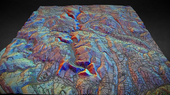
SK15 3D lidar landscape
NOWTAG द्वारा
मुफ़्तCC BYSketchfab
Centred on Dove Dale, Derbyshire (Peak District). 3D model from enhanced LIDAR (DSM, 1m) © Environment Agency copyright and/or database right 2022. All rights reserved. Vertical exaggeration x1.5 Enhancement of the LIDAR was carried out using tools made available in the QGIS plugin, Relief Visuali
यह डिज़ाइन Sketchfab पर होस्ट है। इसकी फ़ाइलें वहीं से, बताए गए लाइसेंस के तहत डाउनलोड होती हैं।
| लाइसेंस | CC BY |
|---|---|
| स्रोत | Sketchfab |
| डिज़ाइनर | NOWTAG |
| श्रेय | NOWTAG on Sketchfab · CC-BY 4.0 (attribution required) · Attribution required |
| टैग | landscape, lidar, dsm, derbyshire, archaeology |
Centred on Dove Dale, Derbyshire (Peak District).
3D model from enhanced LIDAR (DSM, 1m) © Environment Agency copyright and/or database right 2022. All rights reserved. Vertical exaggeration x1.5
Enhancement of the LIDAR was carried out using tools made available in the QGIS plugin, Relief Visualization Toolbox. Kokalj, Žiga & Hesse, Ralf. (2017). Airborne laser scanning raster data visualization: A Guide to Good Practice.
3D landscape model made using the QGIS2threejs plugin for QGIS.
अपने डिज़ाइन प्रकाशित करें
ऐप से STL, 3MF या OBJ फ़ाइलें अपलोड करें। हर अपलोड यहाँ दिखने से पहले जाँचा जाता है, और हर सशुल्क बिक्री का 80% डिज़ाइनर को मिलता है।